Our Services
Professional Aerial Intelligence & Drone Operations
Palmetto Aerial Response provides professional drone services supporting disaster response, search and rescue operations, infrastructure inspections, and aerial mapping. Our mission is to deliver reliable aerial visibility that helps organizations assess conditions, document environments, and make informed operational decisions.
Our drone operations support emergency response teams, contractors, insurers, and property stakeholders across the Southeast United States
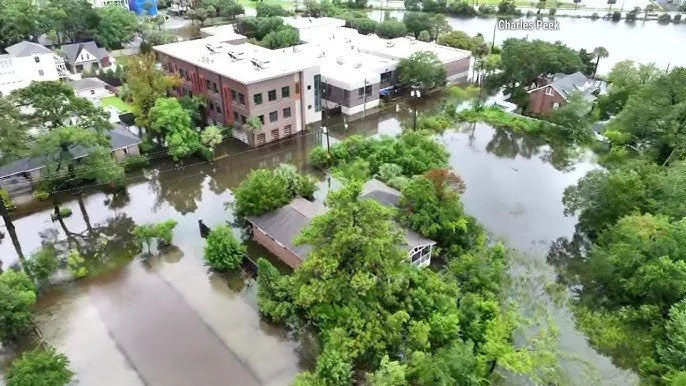
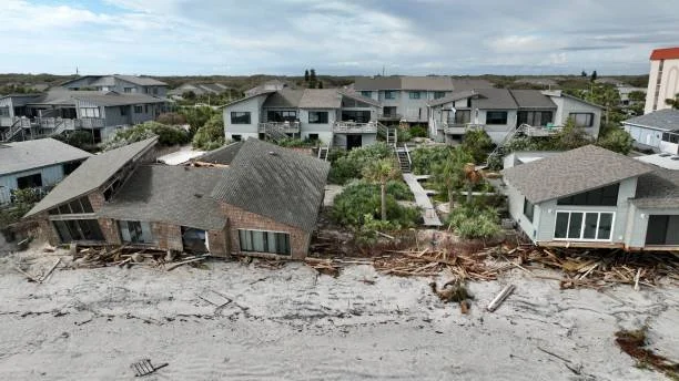
Rapid aerial documentation and damage assessment following storms, flooding, and other major incidents.
Drone imagery allows organizations to quickly understand the scope of damage, assess affected areas, and prioritize response efforts.
Services include:
• Storm damage assessment
• Flood impact documentation
• Infrastructure overview imagery
• Emergency response aerial documentation
• Post-event property and site assessments
Palmetto Aerial Response provides aerial support for search and rescue missions by improving visibility and expanding operational coverage.
Drone deployment can assist ground teams by scanning terrain, identifying access routes, and providing aerial overwatch during search operations.
Capabilities include:
• Aerial search support
• Terrain reconnaissance
• Ground team overwatch
• Mission-area documentation
• Rapid area scanning
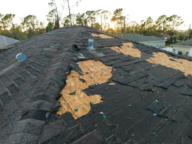
Drone inspections provide a safe and efficient way to capture high-resolution imagery of structures, roofs, and infrastructure.
These services help contractors, insurers, and property managers evaluate conditions without the need for manual roof access or costly equipment.
Inspection services include:
• Roof inspections
• Property and building assessments
• Infrastructure inspection
• Insurance documentation imagery
• Contractor progress inspections
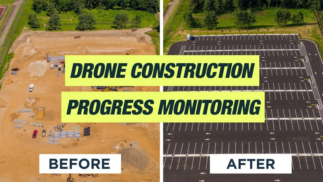
Aerial mapping services provide a detailed overview of construction sites, infrastructure projects, and large properties.
Drone mapping helps teams monitor project progress, capture site documentation, and maintain visual records over time.
Mapping services include:
• Orthomosaic mapping
• Construction progress imagery
• Site overview documentation
• Property and land surveys
• Aerial site imagery
Hazardous Materials & Environmental Support
Palmetto Aerial Response provides aerial imaging and documentation services supporting operations in hazardous and controlled environments. With HAZWOPER-certified training, drone operations are conducted with a strong focus on safety awareness, risk mitigation, and coordination with on-site teams.
Services may include:
• Industrial site aerial assessment
• Post-incident site documentation
• Environmental condition overview
• Infrastructure inspection in restricted areas
• Disaster zone aerial evaluation
Service Area
Palmetto Aerial Response serves clients throughout the Southeast United States, with a primary focus on South Carolina and surrounding regions.
Deployment support may be available for disaster response and project-based operations outside these areas.
Request Aerial Support
If you require professional drone services for inspections, mapping, disaster response, or operational support, Palmetto Aerial Response is ready to assist.
Phone: 843-453-3839
Email: operations@palmettoaerialresponse.com
Or submit a request through our contact page to discuss your project or deployment needs.