
Palmetto Aerial Response
Rapid Aerial Intelligence for Hazardous and Disaster Environments
Palmetto Aerial Response provides professional drone services supporting disaster response, aerial inspections, search and rescue support, and site documentation. Our operations are designed to deliver reliable aerial visibility that helps organizations quickly assess conditions, document environments, and support operational decision-making.
Through high-resolution aerial imagery and professional drone operations, we help clients gain a clear perspective of properties, infrastructure, and environments that may be difficult or unsafe to access from the ground.
Mission-Ready Drone Operations
Palmetto Aerial Response focuses on providing dependable aerial intelligence for organizations that require accurate documentation and situational awareness. Our drone services are designed to support contractors, insurers, property stakeholders, and response teams with professional aerial imagery and operational insight.
We emphasize professionalism, safety, and efficient operations to ensure every mission delivers useful aerial data for clients.
Our Core Services
Palmetto Aerial Response provides drone services across several operational areas.
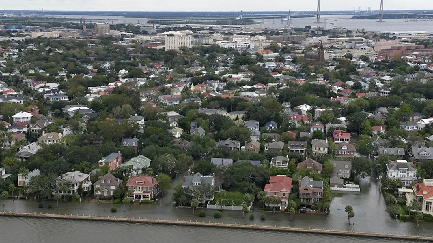
Disaster Response
Following storms, flooding, or major weather events, drone imagery can provide a rapid aerial overview of affected areas. Aerial documentation helps identify damage, assess property conditions, and support response and recovery planning.
Typical services include:
• Storm damage aerial documentation
• Flood impact imagery
• Infrastructure condition overview
• Property and site damage assessment
Search & Rescue Support
Drone technology provides responders with improved visibility during search operations by allowing teams to quickly survey terrain and document mission areas.
Drone support can assist with:
• Aerial reconnaissance
• Terrain overview imagery
• Search area documentation
• Operational visibility for response teams
Aerial Inspection Services
Drone inspections provide a safe and efficient method for capturing detailed imagery of buildings, roofs, and infrastructure.
Inspection services include:
• Roof inspections
• Property condition imagery
• Infrastructure inspections
• Insurance documentation imagery
Drone Mapping & Site Documentation
Drone mapping services provide detailed aerial imagery for construction sites, development projects, and large properties.
Services include:
• Orthomosaic aerial mapping
• Construction progress imagery
• Property and site overview documentation
• Land and infrastructure imagery
Hazardous Environment Operations
Palmetto Aerial Response provides drone-based aerial intelligence for operations involving hazardous and high-risk environments. With HAZWOPER-certified training, our operations are conducted with an understanding of safety protocols, site awareness, and risk management practices relevant to controlled and hazardous environments.
Drone deployment allows for remote visual assessment, helping reduce personnel exposure while providing critical situational awareness.
Professional Standards & Compliance
Palmetto Aerial Response operates in accordance with regulations established for commercial drone operations by the Federal Aviation Administration.
Our operations follow established safety practices and flight planning procedures to ensure responsible and compliant drone missions.
Service Area
Palmetto Aerial Response supports clients across the Southeast United States with a primary focus on:
South Carolina
Deployment support may be available for disaster response operations and project-based missions throughout the region.
Request Aerial Support
If you require professional drone services for inspections, aerial documentation, or operational support, Palmetto Aerial Response is ready to assist.
Phone:843-453-3839
Email:operations@palmettoaerialresponse.com
You may also submit a deployment request through our contact page to discuss your project or operational needs.